
Case Studies
Topographical Land Survey at Knowsley Safari Park
Topographical land survey at Knowsley Safari Park, capturing terrain, buildings, woodland, drainage and animal enclosures across a live visitor attraction.
- Topographical Surveys

Project Overview
Fosse Surveying was commissioned to carry out a detailed topographical land survey at Knowsley Safari Park in Prescot, Merseyside, providing accurate site information to support the development of new visitor attractions and a new animal enclosure area.
The project covered a large and varied area of the park, so there was plenty more to capture than ground levels alone. Our surveyors recorded everything from woodland, mature trees, ponds and drainage features to animal enclosure fencing, visitor paths, roads and tracks. The survey also incorporated existing buildings and structures, viewing areas and infrastructure associated with the park’s miniature railway, creating a detailed picture of how the natural and built environment fits together.
However, this wasn’t a typical development site. The survey took place within a live safari park during the busy summer period, requiring our team to work carefully around visitors, park operations and animal habitats while continuing to capture the accurate information required by the project team.
Scope of work
Our team completed a detailed topographical survey across the required areas of the park, recording the existing landscape and built environment to create an accurate base for future design and development.
The completed survey captured a wide range of site information, including:
- Existing ground levels and contours
- Buildings and structures
- Roads, tracks and pathways
- Tarmac and concrete areas
- Fences, boundaries and enclosure lines
- Trees, woodland and vegetation
- Ponds, drainage and water features
- Existing site infrastructure and street furniture
- Relevant inspection covers and visible services
- Features associated with the park’s miniature railway
- Existing visitor and operational areas
The final survey was related to the Ordnance Survey National Grid using GNSS and the OS Active Network, providing the project team with a coordinated topographical drawing for use throughout the next stages of design.

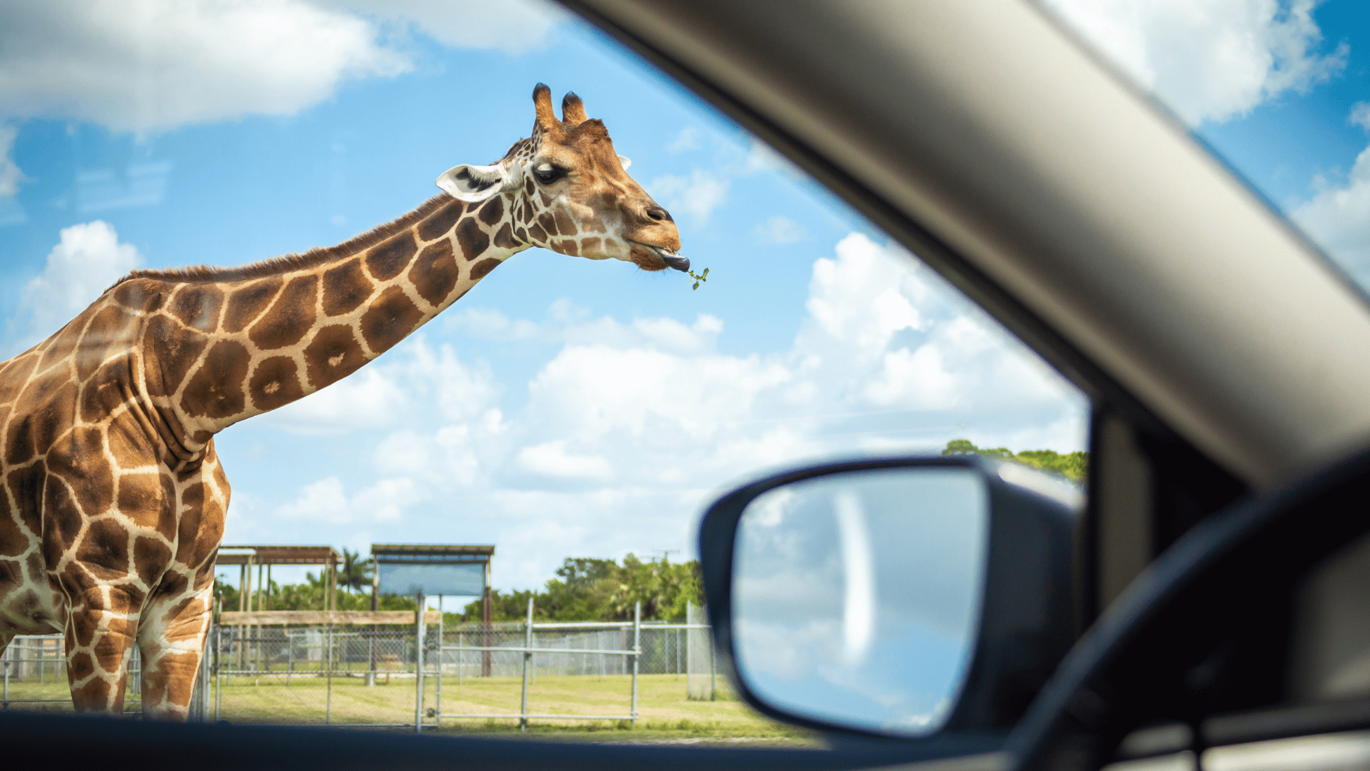
Supporting future development at an iconic visitor attraction
Knowsley Safari has a long history of connecting visitors with wildlife. Set within the historic Knowsley Estate, its roots in animal conservation stretch back to the early 19th century, when Edward Smith Stanley, 13th Earl of Derby, established one of Britain’s largest private animal collections.
The modern safari park opened in 1971 after permission was granted for a 346-acre wildlife reserve, the first of its kind in the North of England. Today, Knowsley welcomes more than half a million visitors each year and continues to invest in its animal habitats and visitor experience.
Fosse Surveying’s work formed part of that continued development, providing the accurate existing-site information needed to help project teams plan new attractions and the proposed enclosure area with confidence.
Surveying a live tourist attraction during the summer
Carrying out a topographical survey at a busy visitor attraction requires a different approach from surveying a vacant development site.
Knowsley Safari operates extensive visitor areas including its five-mile Safari Drive and Foot Safari, alongside animal habitats, rides and other attractions. During the summer, the park also hosts additional events and activities, making careful coordination particularly important.
Our surveyors needed to capture detailed site information while remaining aware of visitors, operational vehicles, park teams and restricted animal areas.
Site access was therefore an important consideration throughout the survey. The drawing records locations where animal enclosures could not be accessed directly, while dense vegetation and other physical restrictions also influenced data capture in parts of the site.
By adapting the survey approach to the environment, our team was able to gather the required information while respecting the day-to-day operation of the park.
Working around animal habitats and complex conditions
A safari park presents surveying challenges that aren’t found on a conventional commercial site.
The landscape combines open grassland, woodland, ponds, buildings, visitor routes and animal habitats, with extensive fencing and significant changes in ground level across parts of the surveyed area. The supplied topographical drawing demonstrates the level of detail required to bring these different elements together into one coordinated survey.
Animal welfare and secure enclosure boundaries also mean surveyors cannot simply access every area in the same way they would on an unrestricted site.
Our team planned data capture around these constraints, using professional surveying equipment and appropriate survey control to record the accessible features and levels required for the project.
The result was a detailed representation of the existing site that could support the design team as plans for the new attractions and animal enclosure progressed.
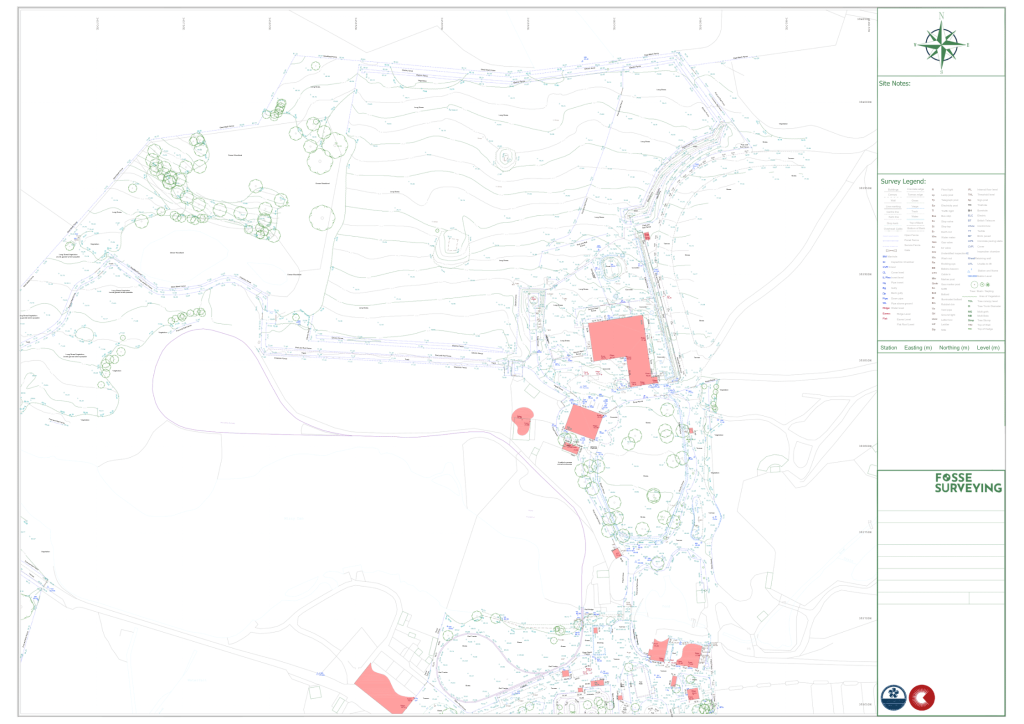
Why accurate topographical surveys matter for leisure developments
Visitor attractions, leisure destinations and zoological sites often combine buildings, landscaping, infrastructure and public spaces within one complex environment.
Before new attractions, enclosures or facilities can be designed, project teams need an accurate understanding of how these existing features relate to one another.
A professional topographical land survey provides architects, landscape designers, engineers and developers with reliable information on existing levels, boundaries, structures and physical site features.
This can support:
- Early feasibility and concept design
- Site and landscape planning
- New buildings and visitor attractions
- Animal habitat and enclosure design
- Access and circulation planning
- Drainage and infrastructure design
- Planning applications
- Detailed construction design
Capturing this information early helps reduce assumptions during design and gives the wider project team a dependable starting point for future development.
Key Achievements
- Detailed survey of a complex site
Captured varied terrain, buildings, infrastructure, vegetation and existing site features. - Supported future park development
Provided accurate data for new visitor attractions and a proposed enclosed area for animals. - Worked within a live attraction
Survey activities were carefully managed around visitors and ongoing park operations. - Adapted to restricted access
Our team worked effectively around animal enclosures, vegetation and site-specific constraints. - Delivered coordinated survey data
Produced a detailed topographical drawing to support subsequent design and development work.
Planning a leisure or visitor attraction development?
Whether you’re developing a visitor attraction, leisure destination, holiday park, public space or other complex operational site, accurate survey information provides the foundation for better planning and design.
Interested in this project?
If you’re looking for a company that provides high quality surveying that offers an excellent all round customer experience, you’ve come to the right place.
- 0116 2325169 office
- 07359 617813 on-site team
- mail@fossesurveying-co-uk.purehost.uk