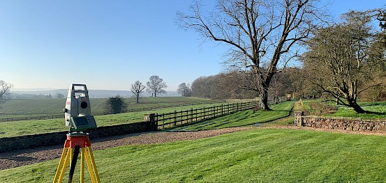
A Topographical Survey (Land Survey) is a key component of any design process for any planned development of an area. It is used by many, from architects, civil engineers, developers, builders and private individuals.
A topographical survey maps the boundaries, building footprints of existing and neighbouring structures, drainage, trees, ground surface types and levels of a site, plus many more features that vary from site to site.
At Fosse Surveying, our trusted and experienced topographical surveyors deliver accurate drawings using the latest technology in the industry to allow for confident site designs and plans.
Our team is on hand to provide advice on a variety of topographic surveys, topological surveys, and land survey issues, including the most suitable survey option for your site, important questions about how the survey works and a full breakdown of a topographical survey cost.
Contact us here.
All of our surveys are related to Ordnance Survey via GNSS site equipment and delivered to our clients needs in DWG, DXF, PDF, CSV, GEN or XYZ formats both in 2D and 3D once professional checked by management once the onsite surveyor has processed the site data in LSS and then AutoCAD.
All of our quotes are based on a full specification topographic survey, so no detail is missed throughout our site visit.
You can view examples of our topographical surveys below. For information about other services, such as Measured Building Surveys or 3D Laser Scanning Surveys, you can browse through our services pages.
Alternatively, please feel free to contact us with any questions.
Fosse Surveying has invested in the latest cutting-edge Leica survey technology to ensure that every survey produced for our clients is to the highest possible standard of accuracy. The latest survey technology is used to give our surveyors the edge with faster and more accurate equipment, which allows you to locate many key features that appear on and off-site.
With our reflectorless survey Leica Total Stations we can gain ridge and eaves heights of the current and neighbouring buildings, overhead cable heights, tree heights, bridge soffits and other key structures.

A topographical land survey provides you with an accurate representation of the condition of your development site. These surveys establish the surrounding infrastructure and any potential restrictions to your site’s boundaries that may affect the completion of your project.
We have a team of topographical survey specialists here at Fosse Surveying. We're pleased to speak with you by phone or email if you have any concerns about what a topographical survey is or if you're ready to arrange a survey and want to narrow down your particular requirements. We recognise that there are many aspects to consider, including a budget; therefore, inquiries about how much topographical survey costs, or more in-depth specifics about topographical land survey costs for particular sites, are always welcome. We always strive to assist our clients in determining the best solution for their projects in terms of quality, pricing, and timeline.
The cost of a topographical survey is relative to the amount of detail that your project requires and the time spent at the site. If you would like any further information, please get in touch for an exact quote.
The following steps are included in a typical land survey: Gathering of essential information, including the land to be surveyed, the required level of detail expected and the most suitable format for the project deliverables The time involved and the subsequent pricing Acquiring the project site data with specialist software The processing of the site data and the generation of Computer Aided Design (Autocad) sketches The conduction of quality assurance checks
At Fosse Surveying, our expert surveyors are skilled in a variety of disciplines and available to answer any questions you may have, including any queries about topographical surveys. Whether you’re looking for more information about topographical surveys or ready to pick up the phone and contact us, our team is here to help you. We understand that you are likely to have a budget and a time frame in mind. We work with you to produce detailed documents to your requirements, on time and within budget. If you have any questions, feel free to give us a call on 0116 2325169 or email us at mail@fossesurveying.co.uk.
Can't find the area you're looking for? Not a problem. We work on projects all over the UK. Fill out the contact form below or call 0116 232 5169 to enquire about a survey in your location.
If you’re looking for a company that provides high quality surveying that offers an excellent all round customer experience, you’ve come to the right place.
Head office:
Old Vicarage, Market Place, Castle Donington, Derbyshire DE74 2JB
Regional Office:
The Old Rectory, Main St, Glenfield, Leicester, LE3 8DG
Regional Office:
Alison Business Centre, 39, 40 Alison Crescent, Sheffield S2 1AS